The following information is from various website available as of March 23, 2024. I’ve found in the past that such great information becomes unavailable due to someone forgetting their value, and missing the rent payment LOL… so the title “More Information about the Bridge” is the link to the place I got it from, etc.
More Information About the Bridge
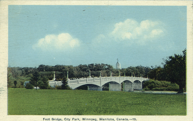
In May 1932 this handsome footbridge was officially opened by Winnipeg Mayor Ralph Webb. Like the Norwood and Main Street bridges, the Winnipeg Auditorium and the Salter street viaduct, the Assiniboine Park Footbridge was partially erected as a Depression relief effort.
Assiniboine Park was the first park in Winnipeg’s suburban parks system. It was created in 1904 and was popular from the outset. Until 1910, visitors accessed the park from the north by ferry across the Assiniboine River. In 1910, the City parks department build a small floating footbridge from the southern bank of the Assiniboine to an island in the middle of the river. Ferries carried visitors from the northern bank to the river island. From 1912 until 1932, the City spent $1,400 a year to build and remove a temporary pontoon bridge (often removed by ice).
The Assiniboine Park Footbridge, which cost $57,000 to complete, was formally opened on May 21, 1932. The concrete cantilever span features five spans at 26.2 metres and two at 13.1 metres (157.4 metres in total). The bridge is 3.7 metres wide.
A Little More about the City of Winnipeg
In 1862, several stores opened in the unincorporated village of Winnipeg, which emerged from within the Red River Settlement. More than a decade later, on November 8, 1873, the Legislature passed An Act to Incorporate the City of Winnipeg, officially making Winnipeg a city and adopting its name. The first election was held the following year on January 5, 1874. The first City Council meeting took place later that month on January 19, 1874. This is why the city has historically commemorated 1874 as its anniversary year.
At the time of incorporation, Winnipeg consisted of about five square kilometers. The city’s southern and eastern boundaries were marked by the Red and Assiniboine rivers. Present-day Maryland Street, Notre Dame Avenue, and McPhillips Street marked its western limits, while Burrows Avenue west of Main Street and Aberdeen Avenue east of Main Street defined its northern boundary. Significant extensions to the boundaries were made in 1875, 1882, 1906, 1962, and 1972.
